Timber cruising is a cornerstone of forest management and has been practiced for centuries in one form or another. At its core, it is the process of evaluating a forest to determine the quantity, quality, and value of its standing timber. Foresters, landowners, and timber companies rely on these surveys to make decisions about harvesting, conservation, or investments. Timber cruising is not a casual stroll through the woods—it is a technical procedure rooted in sampling methods, measurement standards, and statistical accuracy.
The Purpose of Timber Cruising
The ultimate goal of timber cruising is to transform a forest’s biological complexity into measurable information. Landowners want to know what they have, timber companies want to know what they can harvest, and conservationists want to know how much forest should remain untouched. A cruise provides answers to questions such as:
- How much wood is standing per acre?
- What species make up the stand?
- What is the potential market value of the timber?
- Are there signs of disease, fire damage, or poor growth?
This information is then compiled into reports that drive management plans, timber sales, tax valuations, and long-term projections.
Methods of Timber Cruising
There are several ways to conduct a timber cruise, and the chosen method often depends on the size of the tract, terrain, and desired accuracy.
- Fixed-Area Plots: One of the most straightforward methods is to mark out a circle or square of known size, such as one-tenth of an acre, and measure every tree within it. This technique produces detailed data but can be time-consuming in large forests.
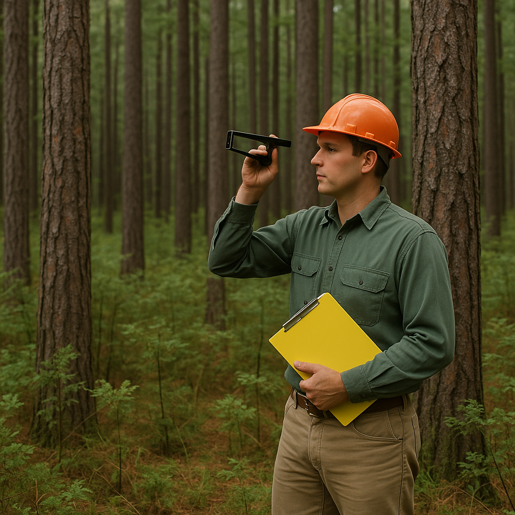
- Variable-Radius Plots: Developed by Walter Bitterlich, this method uses instruments such as a prism or relascope. By sighting trees at breast height, foresters determine whether each tree is “in” or “out” of the sample. This approach is efficient for estimating basal area and volume across large tracts without the need to measure every single tree.
- 100 Percent Tally: For small tracts, especially those being prepared for immediate harvest, every tree is measured. While highly accurate, it is labor-intensive and impractical on a large scale.
What Is Measured During a Cruise
A timber cruise is far more than a simple count of trees. Standard measurements include:
- Diameter at Breast Height (DBH): The diameter of the tree measured 4.5 feet above the ground.
- Height: Both total and merchantable height are recorded, depending on the product class.
- Species: Identifying the tree species is crucial, since market value and end-use vary widely.
- Quality and Defects: Straightness, knots, rot, or disease determine whether a tree is suitable for sawtimber, pulpwood, or veneer.
- Basal Area and Stand Density: Measurements that reflect the amount of wood per unit of land.
Tools of the Trade
A variety of tools are employed in timber cruising, ranging from simple tapes to sophisticated optical instruments.
- Diameter Tape (D-Tape): A tape calibrated to convert circumference directly into diameter.
- Clinometer: Used to measure tree height by sighting the top and base.
- Prism or Relascope: Used for variable-radius plots and basal area estimation.
- GPS and Mapping Tools: Modern cruises often incorporate digital mapping and georeferencing for accuracy.
Today, technology has added laser rangefinders, digital data loggers, and even drones, but the principles remain rooted in tried-and-true field methods.
The Value of a Cruise Report
After days or weeks in the field, data is compiled into a timber cruise report. This document lists the estimated volume per acre, the breakdown of species, quality classes, and the projected value. For a landowner, this report can be a financial ledger. For a timber company, it is the blueprint for harvest planning. For a conservationist, it provides ecological benchmarks that guide sustainable management.
The Human Element
Though timber cruising uses mathematics, statistics, and precision instruments, it also relies on the judgment of experienced foresters. No two trees are exactly alike, and interpreting defects or growth potential often comes down to skill honed over years in the field. The best cruisers can combine objective measurements with subjective assessments to produce reliable inventories.
Timber Cruising in the Modern Era
While drones, satellite imagery, and LiDAR technology are increasingly being used to analyze forests from above, ground-based timber cruising remains indispensable. Remote sensing can identify canopy cover, stand height, and even species in some cases, but it cannot replace the close inspection of tree quality, defects, or exact merchantable volume. Instead, modern forestry blends aerial data with traditional cruising to create a more complete picture of forest resources.

Timber cruising is both science and art, balancing precise measurement with human interpretation. From estimating the number of saw logs in a pine stand to evaluating the potential of a mixed hardwood forest, cruising translates a forest’s natural richness into numbers that guide decisions. Without it, sustainable forestry, fair timber sales, and responsible land management would be impossible.